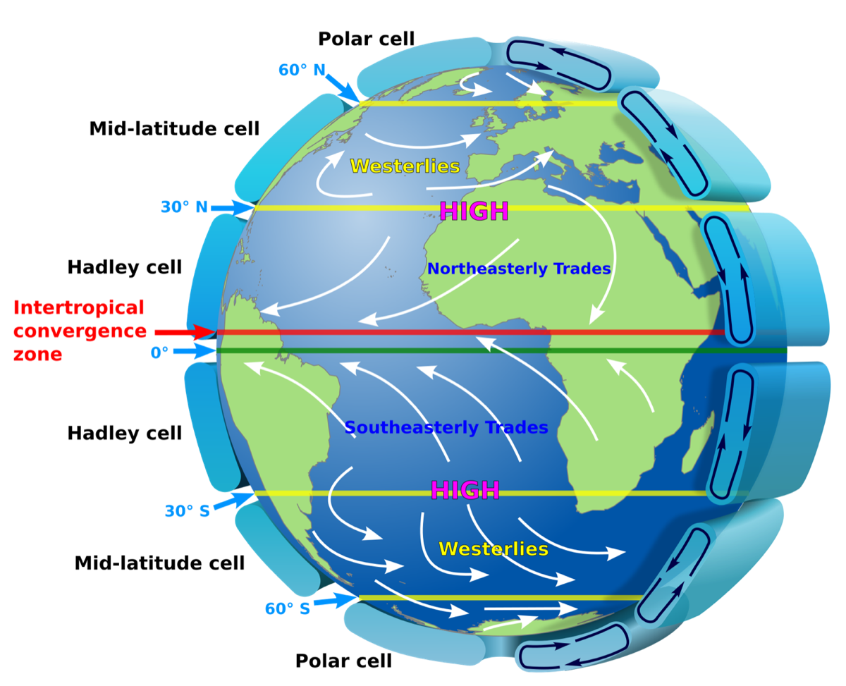
Don’t let your eyes glaze over yet! The diagram above is probably one of the most important in Earth science: the global pattern of winds referred to as the Global Atmospheric Circulation.
It documents what mariners have known for centuries, that winds tend to blow in consistent directions in particular latitudinal bands. The trade winds blow generally from east to west in the Tropics and Subtropics. The Polar Jet Stream, on the other hand, is a component of the high-level winds referred to as the Westerlies that blow from west to east in the midlatitudes.
What drives the perpetual motion machine?
The driver behind it is the excess solar radiation received around the Equator over the course of a year. This uneven heating is attributed to the very high sun angles that predominate in this region, coupled with relatively long and unchanging day lengths. Sun angle is covered in depth in Will it get too warm in the car for Lucky?, and is quickly reviewed here.
In this workshop participants learn in depth about the Global Atmospheric Circulation and its relationships with global wind patterns and atmospheric pressure. This provides insight into aspects of global climates and answers the driving question: why isn’t the Equator the hottest place on Earth?
Standards
The workshop relates directly to NGSS middle school standard MS-ESS2-6: develop and use a model to describe how unequal heating and rotation of the Earth cause patterns of atmospheric and oceanic circulation that determine regional climates.
Format
Two hours. 2 CEUs or SCECHs awarded, with hands-on activities distributed.