Classroom materials

Global Atmospheric Circulation activity packet

Hands-on activities for modeling unequal heating, Earth's rotation, and the global wind and pressure belts that determine regional climates.

For
Middle school
Standards
NGSS MS-ESS2-6
Format
Printable activity packet with teacher notes
Price
Request pricing for classroom or district license
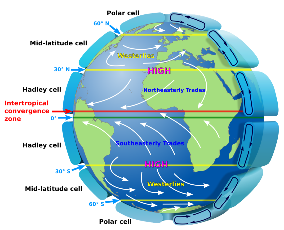
Diagram of the Global Atmospheric Circulation
The Global Atmospheric Circulation. Source: Kaidor, CC BY-SA 3.0, via Wikimedia Commons.

What’s included

  • Activities building the Global Atmospheric Circulation diagram piece by piece, from uneven heating to the three-cell model
  • Worksheets connecting wind belts to atmospheric pressure
  • A regional climates activity answering the driving question: why isn’t the Equator the hottest place on Earth?
  • Teacher notes with background content and answer keys

These are the same activities distributed in the Why isn’t the Equator the hottest place on Earth? workshop.

Pair it with the workshop

These materials are the same packets used in the workshop. Book the workshop and your teachers learn the content and the activities together.

Middle school

Why isn't the Equator the hottest place on Earth?

Probably the most important diagram in Earth science, explained so you can teach it. Uneven heating, Earth's rotation, and the global pattern of winds and pressure that shape regional climates.

Length
2 hours
Credit
2 CEUs / SCECHs
Standards
NGSS MS-ESS2-6

Need materials for a whole grade level or district?

Ask about district licensing, or pair the materials with a workshop so your teachers learn to use them together.